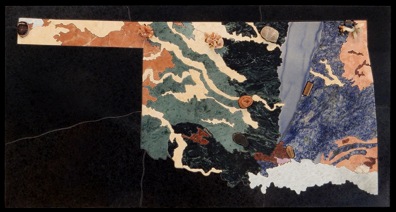
Slabs of: limestone, marble, quartzite, sodalite syenite, travertine, granite, rhodonite;
Minerals: galena with sphalerite, bornite & calcite, Ottawa County; quartz crystals, McCurtain County; barite rosette, probable Garber Sandstone, Oklahoma County; Woodford shale, Grady County; selenite, Alfalfa County; agatized wood, Carrizozo Creek area, Cimarron County;
Fossils: Paciphacops sp., trilobite, Bois d’Arc Fm., Lower Devonian, Coal County; crinoid stem, possibly Des Moines Fm., Mid-Lower Pennsylvanian, Okmulgee County; brachiopod, Permian, Osage County; Captorhinus aquti, reptilian jawbone, Garber Fm., Lower Permian, Dolese Brothers quarry, Comanche County
Sold